WinGPS Yacht Navigator: the navigation software for Delius Klasing charts
WinGPS Yacht Navigator has been specially developed for water sports enthusiasts who want to navigate reliably and up-to-date with
Delius Klasing digital water charts. Thanks to our renewed collaboration, you can now easily use these charts in combination with our user-friendly navigation software.
This program is available for
Windows, Android and iOS. and offers modern navigation functions for both inland waters and marine areas. With a
continuous annual subscription. you are always provided with the latest software updates and improvements.
Why choose WinGPS Yacht Navigator? • Specially developed for Delius Klasing charts: Make optimal use of these detailed water charts in combination with our software.
• Always the latest navigation software: Automatically receive the latest features and improvements within your subscription period.
• Available on multiple platforms: Use WinGPS Yacht Navigator on your Windows laptop, Android tablet or iPad/iPhone.
• Offline navigation: Download your charts and sail without an internet connection.
• Flexible chart options: Water charts can be purchased separately, and the digital water charts from Delius Klasing are available as a subscription.
WinGPS Yacht Navigator features• GPS positioning: See your exact position and course in real time.
• Route planning & waypoints: Plan routes, set waypoints and save important locations.
• Distance measurement: Easily calculate distances between points.
• Use with digital charts: Work with charts from Stentec, Delius Klasing, NOAA and more.
• Route network support for inland waterway charts of Western Europe and the Danube with bridge, lock and waterway data. This allows you to quickly set out and adjust a route, with any obstacles indicated. With waterway name and km while sailing.
• Smart labeling ensures an optimal chart image, so that bridge and lock data can always be read well on course-up rotating charts.
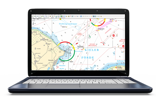
Click on the image for an enlarged view Detail imagesUnlock WinGPS Yacht Navigator When you download the WinGPS Yacht Navigator navigation program to your device and then open it, you will be asked to log in with your Stentec account. If you have a continuous annual subscription to WinGPS Yacht Navigator, the associated functions will be unlocked automatically.
When you terminate the subscription, WinGPS Yacht Navigator will automatically be converted to the Lite version. This will still allow you to determine your position and view the chart, but the additional functions will be lost.
WinGPS Yacht Navigator can be installed on 3 devices with Windows or Android, plus 1 iOS device.
Installing charts When you start WinGPS Yacht Navigator, you will automatically see the (online) topographic base chart from ESRI.
For safe navigation, you can purchase Stentec's digital water charts or subscribe to a Delius Klasing chart. This is easily done via the Stentec online shop. As soon as you have purchased a chart or subscribed to a chart, it will be linked to your account. In WinGPS Yacht Navigator for Android and iOS, you can now download the chart in the app. For WinGPS Yacht Navigator on Windows, install the chart with the Stentec installer. Check the e-mail with the order confirmation and installation instructions.
You may install your chart set on 2 devices, with a third as a reserve. In addition, you can install the chart set on 1 iOS device.


