Stentec’s top navigation software helps you plan the optimal route and therefore provides additional safety at long journeys and extra advantages at regattas. Voyager shows the fastest, shortest, most economical or cheapest route available, both while on engine or under sail.
Not only can you enter the dimensions of your ship, you can also select the polar diagram from a list of over 3000 ships. If your ship is unavailable you can either record your own diagram with WinGPS 6 Voyager and a wind meter or change an existing diagram to the correct data.
With Voyager information on currents and tides is included as well as the option to connect with onboard equipment such as AIS, wind meter, depth meter, autopilot, log and compass.
Download the latest GRIB files for the weather, currents and waves forecast and set your route. Voyager will advise you on the best route, taking the environment and the characteristics of your ship into account.
When the winds are too strong to sail over open water you can easily change the route to inland waterways with the standing mast route. This will give you extra information about bridges & locks and shows how long your new journey will take.
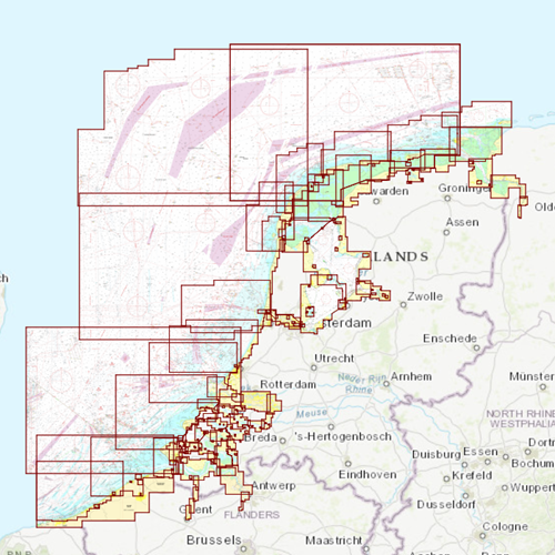
Click on the image for a larger viewDetailed screenshotsMore information:WinGPS navigation software is available for Windows and Android devices which makes it possible to navigate aboard with your laptop, onboard PC, smartphone and tablet. One WinGPS license can be used on two different devices. You are able to plot your routes at home on a desktop PC with a large screen and transfer the data to your onboard device. Another advantage would be to install the software on a second onboard device as backup.
Download GRIB-files for a 7 day weather forecast. During sailing, WinGPS will show your current position, speed and course. Sailed routes will be logged which can be analysed in detail at home or be printed/e-mailed to send to the crew.
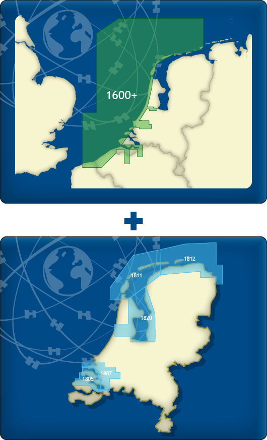 DKW 1600+ and DKW 1800 Complete
With this combination package, you have the most complete digital chart set for the Dutch coastal waters. The
DKW 1600+ and the
DKW 1800 Series Complete connect seamlessly and together offer a clear and reliable overview of all major sailing areas: from the Belgian coast to the IJsselmeer, the Wadden Sea and far out onto the North Sea.
The weekly
Notices to Mariners (NtM/BaZ) are automatically installed in WinGPS, ensuring you always sail with the latest information on buoyage, depths, wind farms and waterway changes.
Thanks to support for both Windows (WinGPS 5/6) and Android (WinGPS Marine), you always have an up-to-date chart available on any device.
Coverage & BenefitsDKW 1600+• Clear coastal charts of the Netherlands and Belgium
• Extra wide North Sea coverage, up to 85 miles offshore
• The Rhine?Meuse delta (Rijnmond area)
• The Westerschelde Western Scheldt up to Antwerp and Ghent
• Includes innovative
alarm zones for restricted areas such as traffic separation schemes and wind farms
• Replacement for the discontinued DKW 1801, 1803 and 1809 charts
DKW 1800 Series Complete• DKW 1805 and 1807: Oosterschelde, Grevelingen, Haringvliet, Hollandsch Diep
• DKW 1820: IJsselmeer, Markermeer, Ketelmeer, North Sea Canal
• DKW 1811 and 1812: Western & Eastern Wadden Sea, incl. adjacent North Sea coast
• Includes monthly
Rijkswaterstaat depth tables (NAP/LAT) for 1811 & 1812
With this combination package, you have one complete, up-to-date and user-friendly overview for all Dutch coastal and inland waters. Ideal for both recreational and professional navigation.
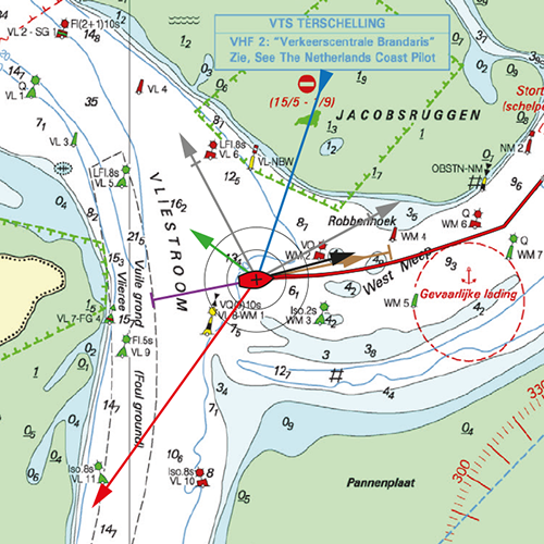
Click on the image for a larger viewDetailed screenshotsWind and currentsThis chart is perfect in combination with WinGPS Pro, WinGPS Voyager and/or WinGPS Marine+. You can easily download the current wind and currents data, for safe route planning.