WinGPS Marine Plus offers you modern, easy to learn navigational tools for a safe trip. Developed for navigation on sailing and motor yachts, sloops and canoes at sea, tidal and inland waters. Ideal when renting or chartering a boat.
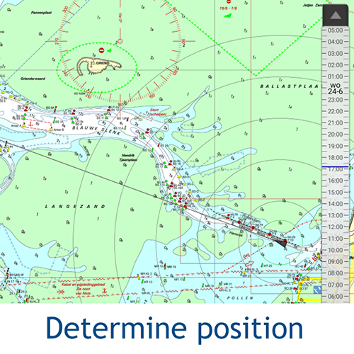
Long press on the chart to plot your route. The GPS on board will show your exact location. Download the charts to your device and go boating offline with the most up-to-date charts. Connect your AIS via WIFI, see the other ships with AIS in advance and prevent possible collisions.
Highlights• Offline navigating on up-to-date charts of Stentec, Imray, NOAA and Delius Klasing.
• SD card support for chart storage.
• Create and save routes, tracks and waypoints.
• NOAA World GRIB files: wind, air pressure, rainfall and temperature.
• Connect AIS and GPS wireless via WIFI or Bluetooth.
• Prevent collisions with the speed vectors of the AIS ships.
• Man-overboard button helps to retrieve lost crewmembers.
• Chart moves along underneath centred GPS position. North-up and course-up.
• Harmonie model KNMI with detailed weather predictions (Netherlands only).
• NOAA wave prediction at open sea (Worldwide).
• Support for the waterways for the inland charts of the Netherlands, Belgium, Germany, France, the Baltic Sea and Donau to the Black Sean, with bridge-, locks and waterway information. With this you can plot and adjust your routes quickly, indicating any obstacles. The names of the waterways and distances will be shown during your trip.
• Smart labeling prevents overlapping text labels for an optimal chart image. Bridge and lock data will always be readable on course-up rotating charts.
Click on an image for a larger viewDetailed screenshotsChart coverage & installing the chartsWhen you start WinGPS Marine you will automatically see the (online) topographic default chart of ESRI. You can also turn on the NOAA charts of the US and download the free world chart via the Chart Manager.
For safe navigation, you can purchase digital charts at
www.stentec.com. It’s also possible to purchase the charts in the app or via Google Play™. Your charts can be installed on 3 different devices. For example, on your Android tablet, phone and Windows laptop or computer.
Log in with your Stentec Account in WinGPS Marine and download or update your purchased DKW2 charts in the Chart Manager.
More information at
wingpsmarine.com.
User inputFor improvement of the app we are very much interested in your experience and suggestions. Please send an e-mail to
helpdesk@stentec.com.
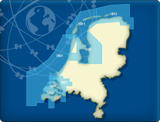 DKW 1800 Complete
This chart set gives you weekly update service, free of charge, with the official ‘messages to mariners’. Also known as the BaZ updates. The charts can be used on a laptop as well as on an Android device. This way you will always have an up-to-date chart of these crowded and unpredictable waters at hand.
As soon as a new paper version of the charts are released by the Dutch Hydrographic Office, users can download these directly in digital form. If desired, the charts can also be printed for personal use.
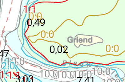
The Waddenzee charts 1811 and 1812 are supplied with monthly updated depth images from Rijkswaterstaat. These depths are in NAP and LAT. Ideal for trips across the shallow waters on the Waddenzee.
Chart coverageThis set consists of the following DKW 1800 series:
• DKW 1801 North Sea coast: the Panne to Den Helder
• DKW 1803 Westerschelde: Vlissingen to Antwerpen
• DKW 1805 Oosterschelde: Veerse Meer and Grevelingenmeer
• DKW 1807 Zoommeer, Volkerak, Spui, Haringvliet and Hollandsch Diep
• DKW 1810 IJsselmeer: Markermeer, Randmeren and Noordzeekanaal
• DKW 1811 Waddensea West: Waddensea West and adjacent North sea coast.
• DKW 1812 Waddensea East: Waddensea East and adjacent North sea coast.
The DKW 1809 is no longer published by the Hydrographic Service. This chart set covered the area: Nieuwe Waterweg, Nieuwe and Oude Maas, Spui and Noord Dordtsche Kil and the Brielse Meer. You can now use the DKW Vaarkaart Nederland (Complete or South) for this area.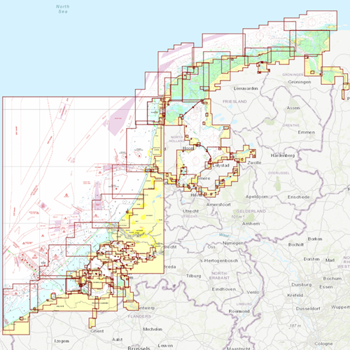
Click on the image for a larger viewDetailed screenshots
 Kustfijn model
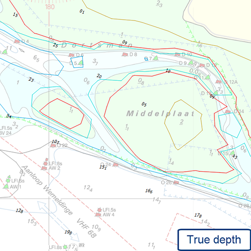
The Kustfijn model gives you the most accurate information about the North Sea and the Waddenzee.
To use this extra information, you need a paid license of WinGPS Marine of Marine Plus. After completing your order, you will receive an e-mail with a license code. Please make sure you have the most recent version of the app. When starting up, you may enter your code. This will allow you to access the extra source right away.
Click on the image for a larger viewDetailed screenshots