Stentec Navigation
Inloggen
en
de
nl
Home
Shop
Contact
Your details
Commercial Shipping
Search results
subscriptions
subscriptions
dkw-coastal-waters-NL
Home / Shop
Find a product
search
Stentec Shop
Navigation Software
Digital Charts
Commercial shipping
Hardware
Pilots & Charts
Books
Simulation Software
back to overview
DKW Inland
Detailed digital charts for water sports and professional inland navigation, specifically for use with WinGPS navigation software.
Click on a chart area for a direct link to the chart set in our webshop.
All chart sets in this series:
<< Previous
| 76 - 100 |
Next >>
Art.nr.
:
All
3209
5001
5002
5003
5004
5005
5006
5007
5008
5009
5010
5011
5012
5013
5014
5021
5022
5023
5051
5052
5053
5054
5055
5056
5057
5058
5059
6223
6224
6225
6226
6227
6228
6231
6232
6233
6234
6236
6237
6238
6239
6240
6303
6304
6305
6306
6307
6308
6310
6311
6312
6313
6321
6322
6323
6330
6331
6335
6336
6355
6356
6357
6358
6481
6482
6483
6484
6485
6500
6501
6502
6503
6514
6551
6552
6553
6554
6555
6556
6573
6574
6575
6585
6591
6592
6593
6594
6595
6596
6597
6598
7203
7204
7207
7208
7209
7210
7211
7212
7213
7214
7215
7216
7221
7225
7227
7260
7261
7262
7263
7267
7268
7269
7273
7285
7410
7411
7420
7421
7430
7434
7435
7438
7450
7451
7460
7461
7465
7466
7470
7471
7472
7473
7474
7475
7480
7482
7484
7701
7702
7703
7704
7705
7706
7707
7710
7711
7712
7713
7714
7715
7716
7717
7720
9303
9304
9305
9306
9307
9308
9310
9311
9323
9324
9332
9333
keyword:
search
NV Atlas 9: Skagen to Rømø - Limfjord
NV Atlas 9: Skagen tot Rømø - Limfjord
Chart
NV 9
Region
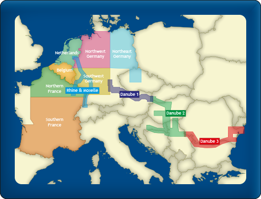
Inland Europe
Edition
2026 / 2027
Chart for
Available as
Atlas + Download
Price from
€ 64,99
More info / Order
more info
NV Bodensee
NV Bodensee
Chart
NV Bodensee
Region
Bodensee
Edition
2022
Chart for
Available as
Kaart + Download
Price from
€ 34,99
More info / Order
more info
NV B1: Berlin & Märkische waters
NV B1: Berlijn & Märkische wateren
Chart
NV B1
Region
Inland Europe
Edition
2024
Chart for
Available as
Ringband + Download
Price from
€ 44,99
More info / Order
more info
NV B2: Berlin & Mecklenburger waters
NV B2: Berlijn & Mecklenburger wateren
Pre-order
Chart
NV B2
Region
Inland Europe
Edition
2026
Chart for
Available as
Ringband + Download
Price from
€ 44,99
More info / Order
more info
NV B3: North Oder & Peene
NV B3: Noordelijke Oder & Peene
Chart
NV B3
Region
Inland Europe
Edition
2023
Chart for
Available as
Ringband + Download
Price from
€ 44,99
More info / Order
more info
NV B4: Elbe & channels
NV B4: Elbe & kanalen
Chart
NV B4
Region
Inland Europe
Edition
2025
Chart for
Available as
Ringband + Download
Price from
€ 44,99
More info / Order
more info
NV B8: Göta channel & Trollhätte channel
NV B8: Götakanaal & Trollhättekanaal
Chart
NV B8
Region
Inland Europe
Edition
2023
Chart for
Available as
Ringband + Download
Price from
€ 44,99
More info / Order
more info
NV Atlas DE10: Nordfriesland (Sylt to Helgoland & Eider)
NV Atlas DE10: Nordfriesland (Sylt tot Helgoland & Eider)
Chart
NV 10
Region
North Sea
Edition
2026
Chart for
Available as
Atlas + Download
Price from
€ 64,99
More info / Order
more info
NV Atlas DE11: The Elbe (Hamburg to Helgoland)
NV Atlas DE11: De Elbe (Hamburg tot Helgoland)
Chart
NV 11
Region
North Sea
Edition
2026
Chart for
Available as
Atlas + Download
Price from
€ 64,99
More info / Order
more info
NV Atlas DE12: The Weser (Bremen to Helgoland & Jade)
NV Atlas DE12: De Weser (Bremen tot Helgoland & Jade)
Chart
NV 12
Region
North Sea
Edition
2026
Chart for
Available as
Atlas + Download
Price from
€ 64,99
More info / Order
more info
NV Atlas DE13: East Frisian Islands (Borkum to Helgoland & Ems)
NV Atlas DE13: Oost-Friese eilanden (Borkum tot Helgoland & Ems)
Chart
NV 13
Region
North Sea
Edition
2026
Chart for
Available as
Atlas + Download
Price from
€ 64,99
More info / Order
more info
NV NO1: Norway Oslofjord North - Oslo to Tønsberg
NV NO1: Noorwegen Oslofjord Noord - Oslo tot Tønsberg
Chart
NV NO1
Region
North Sea
Edition
2026
Chart for
Available as
Atlas + Download
Price from
€ 74,99
More info / Order
more info
NV NO2: Norway Oslofjord South - Svenska Grensen to Kragerø
NV NO2: Noorwegen Oslofjord Zuid - Svenska Grensen tot Kragerø
Chart
NV NO2
Region
North Sea
Edition
2026
Chart for
Available as
Atlas + Download
Price from
€ 74,99
More info / Order
more info
NV NO3: Norway Oslofjord East - Kristiansand to Kragerø
NV NO3: Noorwegen Oslofjord Oost - Kristiansand tot Kragerø
Chart
NV NO3
Region
North Sea
Edition
2026
Chart for
Available as
Atlas + Download
Price from
€ 74,99
More info / Order
more info
NV NO4: Norway Oslofjord West - Flekkefjord to Kristiansand
NV NO4: Noorwegen Oslofjord West - Flekkefjord tot Kristiansand
Chart
NV NO4
Region
North Sea
Edition
2026
Chart for
Available as
Atlas + Download
Price from
€ 74,99
More info / Order
more info
NV NO5: Norway Oslofjord South - Flekkefjord to Stavanger
NV NO5: Noorwegen Oslofjord Zuid - Flekkefjord tot Stavanger
Chart
NV NO5
Region
North Sea
Edition
2023
Chart for
Available as
Atlas + Download
Price from
€ 74,99
More info / Order
more info
NV NO6: Norway Sørvestlandet North - Stavanger to Haugesund
NV NO6: Noorwegen Sørvestlandet Noord - Stavanger tot Haugesund
Chart
NV NO6
Region
North Sea
Edition
2023
Chart for
Available as
Atlas + Download
Price from
€ 74,99
More info / Order
more info
NV Atlas UK1: Isles of Scilly to Start Point
NV Atlas UK1: Isles of Scilly tot Start Point
Chart
NV UK1
Region
North Sea
Edition
2025
Chart for
Available as
Atlas + Download
Price from
€ 64,99
More info / Order
more info
NV Atlas UK2: Start Point to the Needles
NV Atlas UK2: Start Point tot the Needles
Chart
NV UK2
Region
North Sea
Edition
2025
Chart for
Available as
Atlas + Download
Price from
€ 64,99
More info / Order
more info
NV Atlas UK3: The Solent
NV Atlas UK3: The Solent
Chart
NV UK3
Region
North Sea
Edition
2025
Chart for
Available as
Atlas + Download
Price from
€ 64,99
More info / Order
more info
NV Atlas UK4: Selsey Bill to London
NV Atlas UK4: Selsey Bill tot Londen
Chart
NV UK4
Region
North Sea
Edition
2024
Chart for
Available as
Atlas + Download
Price from
€ 64,99
More info / Order
more info
NV Atlas UK5: Thames Estuary to Great Yarmouth
NV Atlas UK5: Thames Estuary tot Great Yarmouth
Chart
NV UK5
Region
North Sea
Edition
2025
Chart for
Available as
Atlas + Download
Price from
€ 64,99
More info / Order
more info
NV Atlas NL1: Borkum to Oostende
NV Atlas NL1: Borkum naar Oostende
Chart
NV NL1
Region
North Sea
Edition
2026
Chart for
Available as
Atlas + Download
Price from
€ 64,99
More info / Order
more info
NV Atlas NL2: Waddensea
NV Atlas NL2: Waddenzee
Chart
NV NL2
Region
North Sea
Edition
2026
Chart for
Available as
Atlas + Download
Price from
€ 64,99
More info / Order
more info
NV Atlas NL3: Ijsselmeer & Randmeren
NV Atlas NL3: IJsselmeer & Randmeren
Chart
NV NL3
Region
North Sea
Edition
2026
Chart for
Available as
Atlas + Download
Price from
€ 64,99
More info / Order
more info
<< Previous
| 76 - 100 |
Next >>
shopping cart
basket is empty
view basket
We accept the following payments:
Login
email address
Password
Login
You forgot your password?