The DKW The Netherlands is developed for sailors, motorboaters and commercial shipping. With its regular updates this chart is
the most up-to-date chart for the inland waterways of the Netherlands.
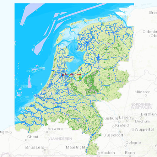
The DKW Vaarkaart Nederland is great for use with the paid versions of WinGPS. Using the waterway network makes it is very easy to plan routes on the Dutch inland waters.
Chart coverageAll the inland waters in the Netherlands are included in this chart. There are 3 extra detail charts included: the Frisian Lakes, the Biesbosch and the Amsterdam waterways. This chart connects to a.o. the DKW 1800 series, Vaarkaart Northwest Germany, Southwest Germany and Belgium.
Click on the image for a larger viewDetailed screenshotsDepth imageStentec releases this chart annually based on the 'Top10NL-data' from the Dutch topographic services, Inland ENC charts, the Dutch Hydrographic services and user based remarks. This chart contains a large level of detail: with 2 meters per pixel, you can zoom up to the dock at your home port.
WaypointsAll the relevant information is shown on the chart as waypoints. Totally there are 114.101 waypoints for a.o. buoys, marinas, Marrekrite moorings, diesel tank stations, water camp sites,
VHF channels, charging stations electric boating and junctions of Varen Doe Je Samen. Also included are waterway signs and
VIN berths for commercial shipping.
More information:
The DKW charts are compatible with both WinGPS 5 and 6 (for Windows), WinGPS Marine (for Android and iOS) and WinGPS Yacht Navigator (for Windows, Android and iOS). A DKW Chart can be used on 3 devices simultaneously.
Productspecifications
| Art.nr.: | 7261 |
| Chart Name: | UPGRADE |
| Producer: | Stentec Software |
| Publisher: | Stentec Software |
| Languages: | Dutch |
| Region: | Inland Europe |
| Edition: | 2026 |
| System Requirements: | Official version of WinGPS 5/6, WinGPS Marine or WinGPS Yacht Navigator.
3,62GB disk space. |


