This chart set gives you weekly update service, free of charge, with the official ‘messages to mariners’. Also known as the BaZ updates. The charts can be used on a laptop as well as on an Android device. This way you will always have an up-to-date chart of these crowded and unpredictable waters at hand.
As soon as a new paper version of the charts are released by the Dutch Hydrographic Office, users can download these directly in digital form. If desired, the charts can also be printed for personal use.
The Waddenzee charts 1811 and 1812 are supplied with monthly updated depth images from Rijkswaterstaat. These depths are in NAP and LAT. Ideal for trips across the shallow waters on the Waddenzee.
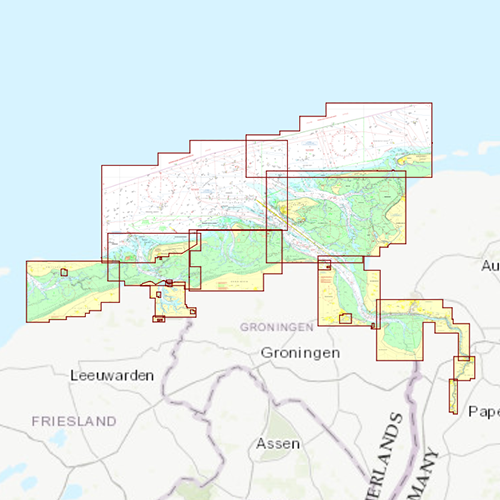
Chart coverage• DKW 1812 Waddensea East: Waddensea East and adjacent North sea coast.
Click on the image for a larger viewDetailed screenshotsWind and currentsThis chart is perfect in combination with WinGPS Pro, WinGPS Voyager and/or WinGPS Marine+. You can easily download the current wind and currents data, for safe route planning.
More information:
The DKW charts are compatible with both WinGPS 5 and 6 (for Windows), WinGPS Marine (for Android and iOS) and WinGPS Yacht Navigator (for Windows, Android and iOS). A DKW Chart can be used on 3 devices simultaneously.


