The DKW Southern France is developed for sailors, motorboaters and commercial shipping.
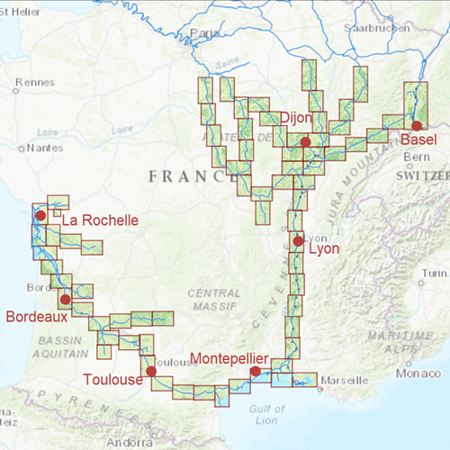
Chart coverageThe DKW Southern France covers all the main inland waterways, from beneath Paris up to the Mediterranean Sea and Atlantic Coast. Including Strasbourg, Basel, Dijon, Lyon, Martigues, Toulouse and Bordeaux. This chart is connect to a.o. DKW North France, Southwest Germany, ID40 and ID50.
Click on the image for a larger viewDetailed ScreenshotsDepth imageThis hybrid chart set gives you a clear depth image and is yearly released by Stentec, using the information of OpenStreetMap and IENC charts. This chart contains a large level of detail: with 2 meters per pixel, you can zoom up to the dock at your home port.
WaypointsAll the relevant information is shown on the chart as waypoints. Totally there are 10.339 waypoints for a.o. buoys, marinas, diesel tank stations, moorings and
VHF channels. Also included are waterway signs and
VIN berths for commercial use. Waypoint groups can be plotted on the charts individually.
More information:
The DKW charts are compatible with both WinGPS 5 and 6 (for Windows), WinGPS Marine (for Android and iOS) and WinGPS Yacht Navigator (for Windows, Android and iOS). A DKW Chart can be used on 3 devices simultaneously.


