Digital chart set based on the popular Imray charts. With free updates in April and July.
Chart coverageThe Mediterranean Coast at the Aegean Sea: the Greek Southeast Coast and the Turkish West Coast. This chart connects to a.o. the DKW ID60.
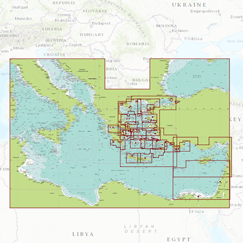
Click on the image for a larger viewDetailed screenshotsClick here to see which Imray charts are included in this set. Depth imageThe depths on this chart have the known Imray colours: deep water is blue and shallow waters are white. This is the opposite of the DKW 1800 series, German Bight and the UK1 English and Scottish East Coast.
Wind and currentsThis chart is perfect in combination with WinGPS Pro, WinGPS Voyager and/or WinGPS Marine+. You can easily download the current wind and currents data, for safe route planning.
More information:
The DKW charts are compatible with both WinGPS 5 and 6 (for Windows), WinGPS Marine (for Android and iOS) and WinGPS Yacht Navigator (for Windows, Android and iOS). A DKW Chart can be used on 3 devices simultaneously.


