The DKW UK1 English & Scottish East Coast is developed for sailors, motorboaters and commercial use within Western Europe.
Chart coverageFrom Dover to Hebriden, with sailing charts for the North Sea, The English Channel, Orkney and the Shetland Islands. Extended with the Scottish East Coast and North Coast. This set contains more detailed charts than the DKW Imray ID10. The UK1 set fits seamlessly to DKW 1800 series, German Bight, ID20 and ID30.
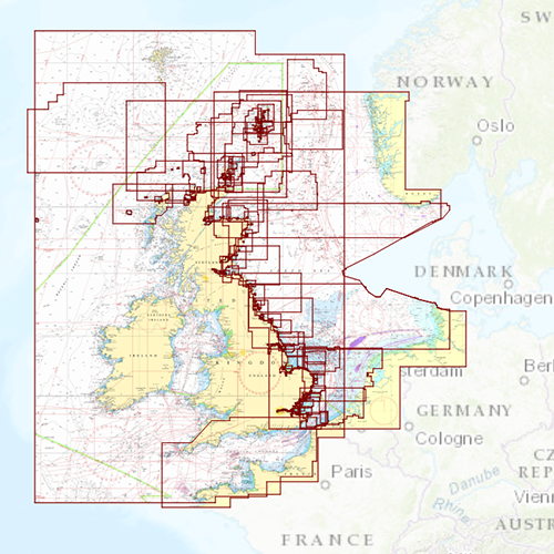
Click on the image for a larger viewDetailed screenshotsDepth imageThe layout and depth colours are the same as on the DKW 1800-series and DKW German Bight, causing these charts to complement each other. Deep water is white and shallow water is coloured. This in contrast to the depth colours of Imray charts.
Wind and currentsThis chart is perfect in combination with WinGPS Pro, WinGPS Voyager and/or WinGPS Marine+. You can easily download the current wind and currents data, for safe route planning.
More information:
The DKW charts are compatible with both WinGPS 5 and 6 (for Windows), WinGPS Marine (for Android and iOS) and WinGPS Yacht Navigator (for Windows, Android and iOS). A DKW Chart can be used on 3 devices simultaneously.


