Combined package with the following DKW charts:
 DKW Danube 1 - West
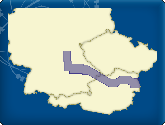
The DKW Danube 1-West is developed for sailors, motorboaters and commercial shipping.
Chart coverageThe Danube 1 covers the western part of the Danube. From Bamberg along Nurnberg, Regensburg, Passau, Linz up to Vienna, almost to Bratislava. This chart is connect to a.o. DKW Southern Germany and Danube2.
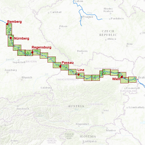
Click on the image for a larger viewDetailed screenshotsDepth imageThis hybrid chart set gives you a clear depth image and is yearly released by Stentec, using the information of OpenStreetMap and IENC charts. This chart contains a large level of detail: with 2 meters per pixel, you can zoom up to the dock at your home port.
WaypointsAll the relevant information is shown on the chart as waypoints. Totally there are 3.747 waypoints for a.o. buoys, marinas, diesel tank stations, moorings and
VHF channels. Also included are waterway signs and
VIN berths for commercial use. Waypoint groups can be plotted on the charts individually.
 DKW Danube 2 - Central
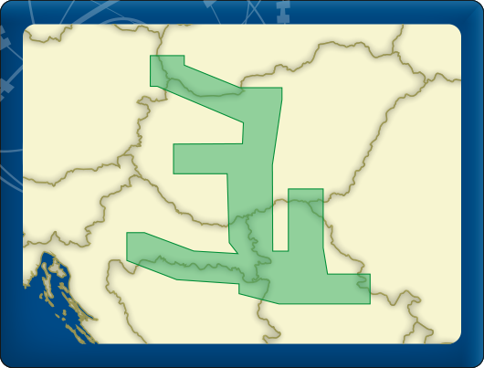
The DKW Danube 2-Central is developed for sailors, motorboaters and commercial shipping.
Chart coverageThe Danube 2 covers the central part of the Danube. From Bratislava along Budapest and the Balaton Lake, up to Szeged, Sisak and Belgrade. This chart is connect to a.o. DKW Danube 1 and Danube 3.
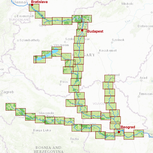
Click on the image for a larger viewDetailed screenshotsDepth imageThis hybrid chart set gives you a clear depth image and is yearly released by Stentec, using the information of OpenStreetMap and IENC charts. This chart contains a large level of detail: with 2 meters per pixel, you can zoom up to the dock at your home port.
WaypointsAll the relevant information is shown on the chart as waypoints. Totally there are 4.273 waypoints for a.o. buoys, marinas, diesel tank stations, moorings and
VHF channels. Also included are waterway signs and
VIN berths for commercial use. Waypoint groups can be plotted on the charts individually.
 DKW Danube 3 - East
The DKW Danube 3-East is developed for sailors, motorboaters and commercial shipping.
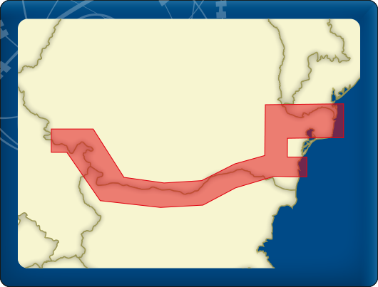
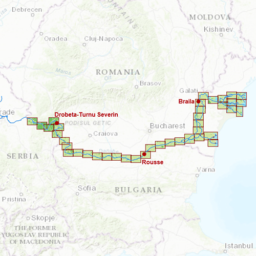
Chart coverageThe Danube 3 covers the eastern part of the Danube. From Golubac (right besides Belgrade) along Drobeta-Turnu Severin, Rousse and Braila, up to the Black Sea at Constanta and the Delta Dunarij. This chart is connect to a.o. DKW Danube 2.
Click on the image for a larger viewDetailed screenshotsDepth imageThis hybrid chart set gives you a clear depth image and is yearly released by Stentec, using the information of OpenStreetMap and IENC charts. This chart contains a large level of detail: with 2 meters per pixel, you can zoom up to the dock at your home port.
WaypointsAll the relevant information is shown on the chart as waypoints. Totally there are 3.936 waypoints for a.o. buoys, marinas, diesel tank stations, moorings and
VHF channels. Also included are waterway signs and
VIN berths for commercial use. Waypoint groups can be plotted on the charts individually.


