The DKW Suriname was developed for water sports enthusiasts and commercial shipping.
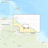
Coverage areaThe entire coast of Suriname, including the crossing from Trinidad to French Guinea. The first part of the Corantijn and Suriname rivers, seen from the sea, are also on the map.
This map seamlessly connects to the DKW ID100 Caribbean East.
Click on the image for an enlarged view Detailed imagesDepth imageThe layout and depth colors are the same as the DKW 1800 series. Deep water is white and shallows are indicated with color.
WindThis map is ideal in combination with WinGPS Pro, WinGPS Voyager and/or WinGPS Marine +. With it you can easily download current wind data for safe route planning.
More information:
The DKW charts are compatible with both WinGPS 5 and 6 (for Windows), WinGPS Marine (for Android and iOS) and WinGPS Yacht Navigator (for Windows, Android and iOS). A DKW Chart can be used on 3 devices simultaneously.


