The DKW Belgium is developed for sailors, motorboaters and commercial shipping and is great for course-up mode with a rotating chart and upright text labels.
Chart coverageThe DKW Belgium covers all the main inland waterways, including the Meuse, IJzer, Bovenschelde, Carleroi-Brussel Canal, Dender and the Ghent-Bruges Canal. This chart is connect to a.o. DKW Netherlands, North France and Southwest Germany.
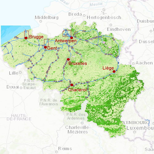
Click on the image for a larger viewDetailed screenshotsDepth imageThis hybrid chart set gives you a clear depth image and is yearly released by Stentec, using the information of OpenStreetMap and IENC charts. This chart contains a large level of detail: with 1 meters per pixel, you can zoom up to the dock at your home port.
WaypointsAll the relevant information is shown on the chart as waypoints. Totally there are 7.816 waypoints for a.o. buoys, marinas, diesel tank stations, moorings, shore power connections and
VHF channels. Also included are waterway signs and
VIN berths for commercial use. Waypoint groups can be plotted on the charts individually.
More information:
The DKW charts are compatible with both WinGPS 5 and 6 (for Windows), WinGPS Marine (for Android and iOS) and WinGPS Yacht Navigator (for Windows, Android and iOS). A DKW Chart can be used on 3 devices simultaneously.
Productspecifications
| Art.nr.: | 7410 |
| Producer: | Stentec Software |
| Publisher: | Stentec Software |
| Languages: | Dutch |
| Region: | Inland Europe |
| Edition: | 2023 + 2024 |
| System Requirements: | Official version of WinGPS 5/6 or WinGPS Marine.
3,0GB disk space. |


