Combined package with the following DKW charts:
 DKW the Netherlands
The DKW The Netherlands is developed for sailors, motorboaters and commercial shipping. With its regular updates this chart is
the most up-to-date chart for the inland waterways of the Netherlands.
The DKW Vaarkaart Nederland is great for use with the paid versions of WinGPS. Using the waterway network makes it is very easy to plan routes on the Dutch inland waters.
Chart coverageAll the inland waters in the Netherlands are included in this chart. There are 3 extra detail charts included: the Frisian Lakes, the Biesbosch and the Amsterdam waterways. This chart connects to a.o. the DKW 1800 series, Vaarkaart Northwest Germany, Southwest Germany and Belgium.
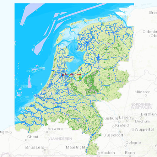
Click on the image for a larger view
 DKW Belgium
The DKW Belgium is developed for sailors, motorboaters and commercial shipping.
Chart coverageThe DKW Belgium covers all the main inland waterways, including the Meuse, IJzer, Bovenschelde, Carleroi-Brussel Canal, Dender and the Ghent-Bruges Canal. This chart is connect to a.o. DKW Netherlands, North France and Southwest Germany.
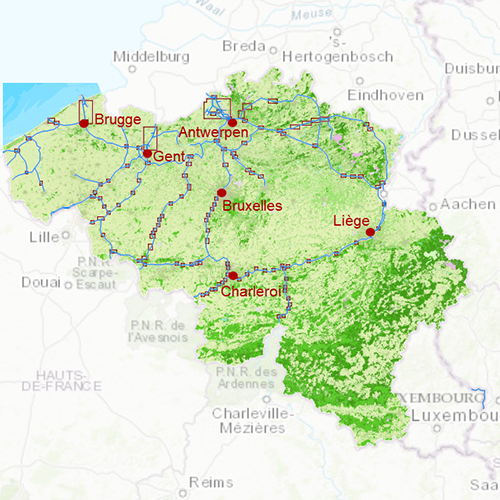
Click on the image for a larger view
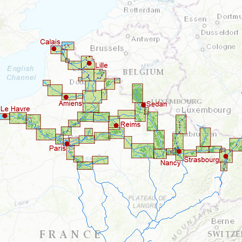
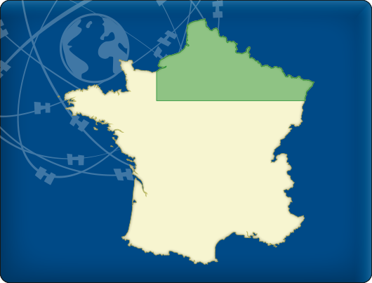 DKW Northern France
The DKW Northern France is developed for sailors, motorboaters and commercial shipping.
Chart coverageThe DKW Northern France covers all the main inland waterways, from the Belgium, Luxemburg and German border up to Paris. From Dunkirk along Lille, Amiens, Rouen, Reims and Nancy, to Le Croty, Le Havre, Nogen-sur-Seine and Strasbourg. This chart is connect to a.o. DKW Belgium, South France and Southwest Germany.
Click on the image for a larger view
Depth imageThis hybrid chart set gives you a clear depth image and is yearly released by Stentec, using the information of OpenStreetMap and IENC charts. This chart contains a large level of detail: with 2 meters per pixel, you can zoom up to the dock at your home port.
WaypointsAll the relevant information is shown on the chart as waypoints with a.o. buoys, marinas, diesel tank stations, moorings and
VHF channels. Also included are waterway signs and
VIN berths for commercial use. Waypoint groups can be plotted on the charts individually.


