Developed by Delius Klasing for watersport enthusiasts and commercial shipping on the Adriatic Sea.
Please note: DKW DK digital-charts are available only as annual subscriptions (365 days). Upon purchase, you authorise an annual direct debit. For this, an amount of € 0.01 will first be debited on the first payment and after 2-3 working days the total amount of your order will be debited. Without cancellation, the subscription is automatically renewed for another year. This way, the chart always remains up-to-date and you can sail carefree!
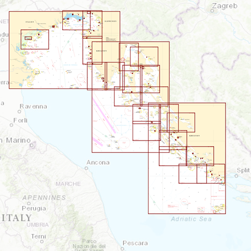
Chart coverageThis chart covers the Northeast of the Adriatic Coast, from Venice along Triëst, Pula, Rijeka, Zadar to Šibenik. Including all the corresponding islands, such as a.o. : Murter, Kornati, Pašman, Ugljan, Pag, Krk, Cres and Rab.
Click on the image for a larger viewDetail images Depth imageThe clear depth colours are the same as the DKW 1800 series and DKW German Bight. Therefor these charts can be perfectly used together. Deep water is white and shallow waters are coloured.
WindThis chart is perfect in combination with WinGPS Pro, WinGPS Voyager and/or WinGPS Marine+. You can easily download the current wind and currents data, for safe route planning.
More information:
The DKW charts are compatible with both WinGPS 5 and 6 (for Windows), WinGPS Marine (for Android and iOS) and WinGPS Yacht Navigator (for Windows, Android and iOS). A DKW Chart can be used on 3 devices simultaneously.